 vesseltracker.com
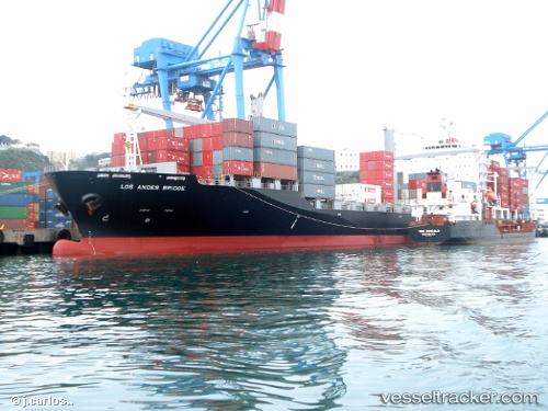
Los Andes Bridge
Current StatusWhere is the vessel?
Los Andes Bridge is currently in 14 nm NW of Iba, based on AIS data received less than 1h ago.
Latest AIS update:
Current position: 15.43815° N, 119.76720° E (14 nm NW of Iba)
Average speed (last 7 days): Loading…
Average speed (last 30 days): Loading…
Vessel profile: Los Andes Bridge is a Container Ship with dimensions 32m x 200m.
This page combines live AIS, route history, probable destination signals, nearby traffic, and port activity for practical vessel monitoring.
The current position of vessel Los Andes Bridge is 15.43815 lat / 119.76720 lng. Updated: 2026-05-16 03:26:19 UTCNearest reference points:
- 34 nm W of Iba
- 19 nm SW of MARIVELES
- Near Malabon
Details:
Live Vessel Los Andes Bridge Analytics (details, animations, etc.)
Recent AIS points (UTC):
2026-05-15 23:52:11 UTC · 16.33500, 119.72833 · SOG 15 kn · COG -1°2026-05-16 01:12:44 UTC · 15.99779, 119.67988 · SOG 15.2 kn · COG 177°
2026-05-16 02:19:26 UTC · 15.71579, 119.71232 · SOG 15.2 kn · COG 170°
2026-05-16 03:26:19 UTC · 15.43815, 119.76720 · SOG 15.1 kn · COG 165°