 vesseltracker.com
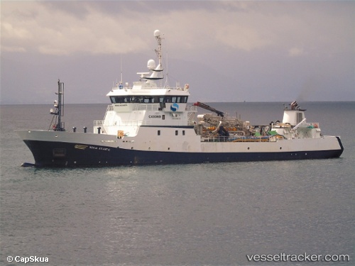
Ronia Atlantic
Current StatusWhere is the vessel?
Ronia Atlantic is currently in 34 nm W of Puerto Chacabuco, based on AIS data received about 1h ago.
Latest AIS update:
Current position: 45.65165° S, 73.60790° W (34 nm W of Puerto Chacabuco)
Average speed (last 7 days): Loading…
Average speed (last 30 days): Loading…
Vessel profile: Ronia Atlantic is a Fish Carrier with dimensions 14m x 68m.
This page combines live AIS, route history, probable destination signals, nearby traffic, and port activity for practical vessel monitoring.
The current position of vessel Ronia Atlantic is -45.65165 lat / -73.60790 lng. Updated: 2026-05-16 11:27:32 UTCNearest reference points:
- 68 nm W of Puerto Chacabuco
- Near Melinka
Details:
Live Vessel Ronia Atlantic Analytics (details, animations, etc.)
Recent AIS points (UTC):
2026-05-16 08:02:50 UTC · -45.65167, -73.60667 · SOG 0 kn · COG -1°2026-05-16 10:11:47 UTC · -45.65167, -73.60667 · SOG 0 kn · COG -1°
2026-05-16 10:26:50 UTC · -45.65167, -73.60667 · SOG 0 kn · COG -1°
2026-05-16 11:27:32 UTC · -45.65165, -73.60790 · SOG 0 kn · COG 303°