 vesseltracker.com
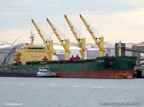
 XIN HAI TONG 27
Current Status
Where is the vessel?
XIN HAI TONG 27 is currently in Near JINHAI HEAVY INDUSTR, based on AIS data received about 1h ago.
Latest AIS update:
Current position: 30.26233° N, 122.25253° E (Near JINHAI HEAVY INDUSTR)
Average speed (last 7 days): Loading…
Average speed (last 30 days): Loading…
Vessel profile: XIN HAI TONG 27 is a Bulk Carrier with dimensions 32m x 190m.
This page combines live AIS, route history, probable destination signals, nearby traffic, and port activity for practical vessel monitoring.
The current position of vessel XIN HAI TONG 27 is 30.26233 lat / 122.25253 lng. Updated: 2026-05-02 18:12:57 UTCNearest reference points:
- Near JINHAI HEAVY INDUSTR
- Near Majistan/Zhoushan
- 11 nm N of JINHAI HEAVY INDUSTR
Currently sailing under the flag of Marshall Islands ![]()
XIN HAI TONG 27 built in 2011 year
Deadweight:
56738 tDetails:
Live Vessel XIN HAI TONG 27 Analytics (details, animations, etc.)
Recent AIS points (UTC):
2026-05-02 13:57:49 UTC · 30.26241, 122.25258 · SOG 0 kn · COG 192°2026-05-02 15:21:55 UTC · 30.26233, 122.25253 · SOG 0 kn · COG 192°
2026-05-02 16:30:53 UTC · 30.26231, 122.25248 · SOG 0.1 kn · COG 192°
2026-05-02 18:12:57 UTC · 30.26233, 122.25253 · SOG 0 kn · COG 192°