 vesseltracker.com
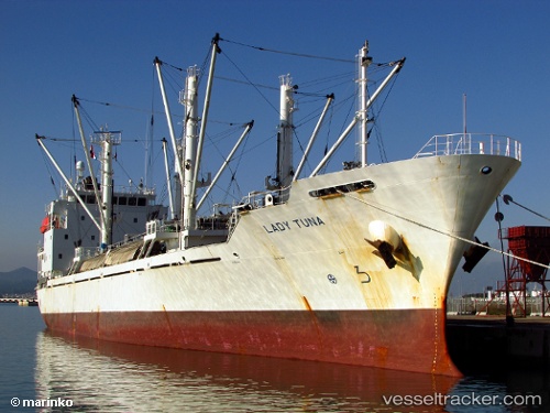
Lady Tuna
Current StatusWhere is the vessel?
Lady Tuna is currently in Near Choa Chu Kang, based on AIS data received about 1h ago.
Latest AIS update:
Current position: 1.25860° N, 103.87170° E (Near Choa Chu Kang)
Average speed (last 7 days): Loading…
Average speed (last 30 days): Loading…
Vessel profile: Lady Tuna is a Refrigerated Cargo Ship with dimensions 17m x 121m.
This page combines live AIS, route history, probable destination signals, nearby traffic, and port activity for practical vessel monitoring.
The current position of vessel Lady Tuna is 1.25860 lat / 103.87170 lng. Updated: 2026-05-15 14:03:09 UTCNearest reference points:
- Near Choa Chu Kang
- Near Singapore
- Near Tampines
Details:
Live Vessel Lady Tuna Analytics (details, animations, etc.)
Recent AIS points (UTC):
2026-05-15 11:00:11 UTC · 1.25783, 103.87037 · SOG 0.1 kn · COG 6°2026-05-15 11:36:09 UTC · 1.25775, 103.87046 · SOG 0 kn · COG 2°
2026-05-15 13:24:10 UTC · 1.25821, 103.87162 · SOG 0.2 kn · COG 297°
2026-05-15 14:03:09 UTC · 1.25860, 103.87170 · SOG 0 kn · COG 271°