 vesseltracker.com
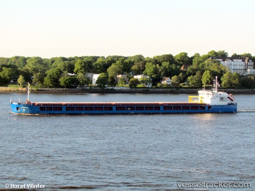
 LAKER 1
Current Status
Where is the vessel?
LAKER 1 is currently in Near BAKIRKOY, based on AIS data received less than 1h ago.
Latest AIS update:
Current position: 40.94408° N, 28.86045° E (Near BAKIRKOY)
Average speed (last 7 days): Loading…
Average speed (last 30 days): Loading…
Vessel profile: LAKER 1 is a General Cargo with dimensions m x m.
This page combines live AIS, route history, probable destination signals, nearby traffic, and port activity for practical vessel monitoring.
The current position of vessel LAKER 1 is 40.94408 lat / 28.86045 lng. Updated: 2026-04-23 13:15:28 UTCNearest reference points:
- Near BAKIRKOY
- Near ZEYTINBURNU
- Near Davutpasa
Currently sailing under the flag of Sierra Leone ![]()
Details:
Live Vessel LAKER 1 Analytics (details, animations, etc.)
Recent AIS points (UTC):
2026-04-23 09:54:55 UTC · 40.94258, 28.85961 · SOG 0 kn · COG 67°2026-04-23 10:38:02 UTC · 40.94212, 28.86002 · SOG 0.1 kn · COG 41°
2026-04-23 11:27:23 UTC · 40.94253, 28.85970 · SOG 0.1 kn · COG 64°
2026-04-23 13:15:28 UTC · 40.94408, 28.86045 · SOG 0.2 kn · COG 142°