 vesseltracker.com
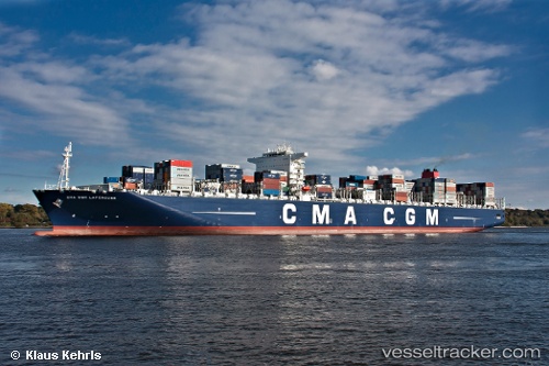
 CMA CGM LAPEROUSE
Current Status
Where is the vessel?
CMA CGM LAPEROUSE is currently in 185 nm S of Xijiang, based on AIS data received about 1h ago.
Latest AIS update:
Current position: 18.21500° N, 114.57500° E (185 nm S of Xijiang)
Average speed (last 7 days): Loading…
Average speed (last 30 days): Loading…
Vessel profile: CMA CGM LAPEROUSE is a Container Ship with dimensions 365m x 52m.
This page combines live AIS, route history, probable destination signals, nearby traffic, and port activity for practical vessel monitoring.
The current position of vessel CMA CGM LAPEROUSE is 18.215 lat / 114.575 lng. Updated: 2026-04-30 11:29:48 UTCNearest reference points:
- 123 nm S of Shadi
- 78 nm SW of Xijiang
Currently sailing under the flag of Malta ![]()
CMA CGM LAPEROUSE built in 2010 year
Deadweight:
165422 tDetails:
Live Vessel CMA CGM LAPEROUSE Analytics (details, animations, etc.)
Recent AIS points (UTC):
2026-04-30 07:55:10 UTC · 17.49840, 114.08900 · SOG 14.4 kn · COG 32°2026-04-30 09:34:53 UTC · 17.83710, 114.31000 · SOG 14.3 kn · COG 35°
2026-04-30 10:22:41 UTC · 17.99190, 114.42000 · SOG 14.3 kn · COG 30°
2026-04-30 11:29:48 UTC · 18.21500, 114.57500 · SOG 14 kn · COG -1°