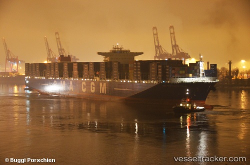
Cma Cgm Marco Polo
Current StatusWhere is the vessel?
Cma Cgm Marco Polo is currently in Near Ras Gharib, based on AIS data received about 16h ago.
Latest AIS update:
Current position: 28.34625° N, 33.16106° E (Near Ras Gharib)
Average speed (last 7 days): Loading…
Average speed (last 30 days): Loading…
Vessel profile: Cma Cgm Marco Polo is a Container Ship with dimensions 54m x 396m.
This page combines live AIS, route history, probable destination signals, nearby traffic, and port activity for practical vessel monitoring.
The current position of vessel Cma Cgm Marco Polo is 28.34625 lat / 33.16106 lng. Updated: 2026-05-23 19:44:59 UTCNearest reference points:
- Near Ras Gharib
- 19 nm SE of Zeit Bay
- Near El-Guna (El Gouna)
Details:
Live Vessel Cma Cgm Marco Polo Analytics (details, animations, etc.)
Recent AIS points (UTC):
2026-05-23 16:10:17 UTC · 29.03847, 32.78784 · SOG 12.8 kn · COG 159°2026-05-23 18:19:59 UTC · 28.61621, 32.99271 · SOG 12.9 kn · COG 152°
2026-05-23 19:44:59 UTC · 28.34625, 33.16106 · SOG 13 kn · COG 147°
2026-05-23 19:44:59 UTC · 28.34625, 33.16106 · SOG 13 kn · COG 147°