 vesseltracker.com
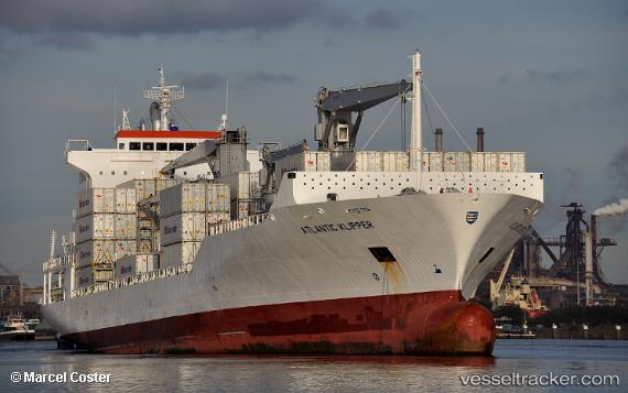
 ATLANTIC KLIPPER
Current Status
Where is the vessel?
ATLANTIC KLIPPER is currently in 43 nm NE of Pinos Puente, based on AIS data received less than 1h ago.
Latest AIS update:
Current position: 37.53218° N, 33.99502° W (43 nm NE of Pinos Puente)
Average speed (last 7 days): Loading…
Average speed (last 30 days): Loading…
Vessel profile: ATLANTIC KLIPPER is a Reefer/Container Ship with dimensions m x m.
This page combines live AIS, route history, probable destination signals, nearby traffic, and port activity for practical vessel monitoring.
The current position of vessel ATLANTIC KLIPPER is 37.53218 lat / -33.99502 lng. Updated: 2026-05-14 07:41:44 UTCNearest reference points:
- 107 nm SE of Sariseki
Currently sailing under the flag of Liberia ![]()
Details:
Live Vessel ATLANTIC KLIPPER Analytics (details, animations, etc.)
Recent AIS points (UTC):
2026-05-14 04:05:12 UTC · 38.19195, -32.93319 · SOG 18 kn · COG 231°2026-05-14 06:08:13 UTC · 37.82182, -33.54605 · SOG 18.2 kn · COG 233°
2026-05-14 07:03:52 UTC · 37.65358, -33.82405 · SOG 17.6 kn · COG 227°
2026-05-14 07:41:44 UTC · 37.53218, -33.99502 · SOG 17.2 kn · COG 227°