 vesseltracker.com
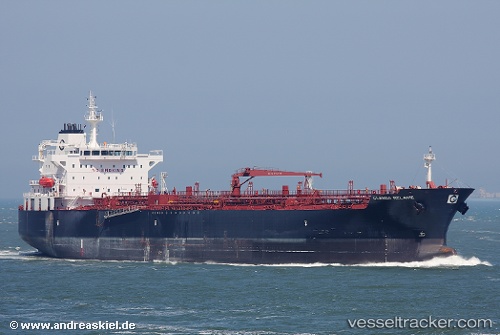
 RUI FU XING
Current Status
Where is the vessel?
RUI FU XING is currently in 23 nm SW of SHUAIBAH, based on AIS data received about 115d ago.
Latest AIS update:
Current position: 20.34108° N, 39.28348° E (23 nm SW of SHUAIBAH)
Average speed (last 7 days): Loading…
Average speed (last 30 days): Loading…
Vessel profile: RUI FU XING is a Oil/Chemical Tanker with dimensions m x m.
This page combines live AIS, route history, probable destination signals, nearby traffic, and port activity for practical vessel monitoring.
The current position of vessel RUI FU XING is 20.34108 lat / 39.28348 lng. Updated: 2026-01-21 07:53:33 UTCNearest reference points:
- 53 nm SW of SHUAIBAH
- 10 nm SW of Jeddah
- Near Jeddah
Currently sailing under the flag of Bahamas ![]()
Details:
Live Vessel RUI FU XING Analytics (details, animations, etc.)
Recent AIS points (UTC):
2026-01-21 07:53:33 UTC · 20.34108, 39.28348 · SOG 1.1 kn · COG 57°