 TANZANITE
Current Status
Where is the vessel?
TANZANITE is currently in Near Miramar, based on AIS data received about 15h ago.
Latest AIS update:
Current position: 22.47834° N, 97.88759° W (Near Miramar)
Average speed (last 7 days): Loading…
Average speed (last 30 days): Loading…
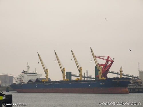
Vessel profile: TANZANITE is a Bulk Carrier with dimensions 32m x 190m.
This page combines live AIS, route history, probable destination signals, nearby traffic, and port activity for practical vessel monitoring.
The current position of vessel TANZANITE is 22.47834 lat / -97.88759 lng. Updated: 2026-05-23 19:31:56 UTCNearest reference points:
- 25 nm E of Tuxpan
Currently sailing under the flag of Liberia ![]()
TANZANITE built in 2010 year
Deadweight:
56835 tDetails:
Live Vessel TANZANITE Analytics (details, animations, etc.)
Recent AIS points (UTC):
2026-05-23 16:07:57 UTC · 22.47840, -97.88757 · SOG 0 kn · COG 348°2026-05-23 18:10:59 UTC · 22.47841, -97.88760 · SOG 0 kn · COG 348°
2026-05-23 19:25:59 UTC · 22.47839, -97.88762 · SOG 0 kn · COG 348°
2026-05-23 19:31:56 UTC · 22.47834, -97.88759 · SOG 0 kn · COG 348°