 vesseltracker.com
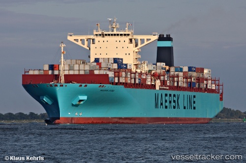
 Maersk Evora
Current Status
Where is the vessel?
Maersk Evora is currently in Open sea (no nearby ports in database), based on AIS data received less than 1h ago.
Latest AIS update:
Current position: 41.10957° N, 158.21085° W (Open sea (no nearby ports in database))
Average speed (last 7 days): Loading…
Average speed (last 30 days): Loading…
Vessel profile: Maersk Evora is a Container Ship with dimensions 366m x 48m.
This page combines live AIS, route history, probable destination signals, nearby traffic, and port activity for practical vessel monitoring.
The current position of vessel Maersk Evora is 41.10957 lat / -158.21085 lng. Updated: 2026-05-15 11:28:20 UTCNearest reference points:
- Open sea (no nearby ports in database)
- Open sea, approx. 430 nm off the nearest listed port
- Open sea, approx. 437 nm off the nearest listed port
Currently sailing under the flag of Denmark ![]()
Maersk Evora built in 2011 year
Deadweight:
142105 tDetails:
Live Vessel Maersk Evora Analytics (details, animations, etc.)
Recent AIS points (UTC):
2026-05-15 08:04:55 UTC · 41.25476, -159.52753 · SOG 17.4 kn · COG 98°2026-05-15 09:36:37 UTC · 41.18819, -158.93692 · SOG 17.9 kn · COG 100°
2026-05-15 10:38:37 UTC · 41.14561, -158.53334 · SOG 17.8 kn · COG 100°
2026-05-15 11:28:20 UTC · 41.10957, -158.21085 · SOG 17.7 kn · COG 99°