 vesseltracker.com
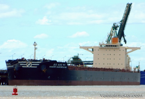
 Hl Dalrymple Bay
Current Status
Where is the vessel?
Hl Dalrymple Bay is currently in 111 nm E of Ebene, based on AIS data received about 1h ago.
Latest AIS update:
Current position: 19.96122° S, 59.72603° E (111 nm E of Ebene)
Average speed (last 7 days): Loading…
Average speed (last 30 days): Loading…
Vessel profile: Hl Dalrymple Bay is a Bulk Carrier with dimensions 292m x 45m.
This page combines live AIS, route history, probable destination signals, nearby traffic, and port activity for practical vessel monitoring.
The current position of vessel Hl Dalrymple Bay is -19.96122 lat / 59.72603 lng. Updated: 2026-05-02 13:42:22 UTCNearest reference points:
- 159 nm W of Rodrigues
- Near Port Louis
- 106 nm NW of Port Mathurin
Currently sailing under the flag of Panama ![]()
Hl Dalrymple Bay built in 2010 year
Deadweight:
179147 tDetails:
Live Vessel Hl Dalrymple Bay Analytics (details, animations, etc.)
Recent AIS points (UTC):
2026-05-02 10:57:11 UTC · -20.22803, 59.30245 · SOG 10.5 kn · COG 65°2026-05-02 11:46:01 UTC · -20.14840, 59.42707 · SOG 10.2 kn · COG 65°
2026-05-02 13:15:40 UTC · -20.00572, 59.65787 · SOG 10.5 kn · COG 58°
2026-05-02 13:42:22 UTC · -19.96122, 59.72603 · SOG 10.5 kn · COG 57°