 vesseltracker.com
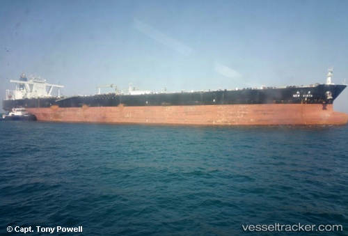
New Vista
Current StatusWhere is the vessel?
New Vista is currently in 65 nm SW of Lakshadweep, based on AIS data received about 6h ago.
Latest AIS update:
Current position: 9.56469° N, 71.99942° E (65 nm SW of Lakshadweep)
Average speed (last 7 days): Loading…
Average speed (last 30 days): Loading…
Vessel profile: New Vista is a Crude Oil Tanker with dimensions 60m x 330m.
This page combines live AIS, route history, probable destination signals, nearby traffic, and port activity for practical vessel monitoring.
The current position of vessel New Vista is 9.56469 lat / 71.99942 lng. Updated: 2026-05-14 00:12:30 UTCNearest reference points:
- 13 nm NW of Lakshadweep
- 130 nm W of Lakshadweep
- 45 nm SW of Kalpeni Island
Details:
Live Vessel New Vista Analytics (details, animations, etc.)
Recent AIS points (UTC):
2026-05-14 00:12:30 UTC · 9.56469, 71.99942 · SOG 12.2 kn · COG 100°2026-05-14 00:12:30 UTC · 9.56469, 71.99942 · SOG 12.2 kn · COG 100°
2026-05-14 00:12:30 UTC · 9.56469, 71.99942 · SOG 12.2 kn · COG 100°
2026-05-14 00:12:30 UTC · 9.56469, 71.99942 · SOG 12.2 kn · COG 100°