 vesseltracker.com
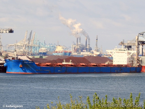
 CAPE PROTEUS
Current Status
Where is the vessel?
CAPE PROTEUS is currently in 68 nm N of Chan May Port, based on AIS data received about 1h ago.
Latest AIS update:
Current position: 17.43898° N, 108.26776° E (68 nm N of Chan May Port)
Average speed (last 7 days): Loading…
Average speed (last 30 days): Loading…
Vessel profile: CAPE PROTEUS is a Bulk Carrier with dimensions m x m.
This page combines live AIS, route history, probable destination signals, nearby traffic, and port activity for practical vessel monitoring.
The current position of vessel CAPE PROTEUS is 17.43898 lat / 108.26776 lng. Updated: 2026-05-14 10:44:09 UTCNearest reference points:
- 48 nm NE of Cua Viet Port
- 60 nm SW of Ledong
- 61 nm E of Hon La Port
Currently sailing under the flag of Liberia ![]()
Details:
Live Vessel CAPE PROTEUS Analytics (details, animations, etc.)
Recent AIS points (UTC):
2026-05-14 07:45:09 UTC · 17.77562, 107.83820 · SOG 11 kn · COG 130°2026-05-14 07:58:28 UTC · 17.74957, 107.87040 · SOG 11 kn · COG 130°
2026-05-14 09:24:18 UTC · 17.58027, 108.07640 · SOG 10.8 kn · COG 133°
2026-05-14 10:44:09 UTC · 17.43898, 108.26776 · SOG 10.4 kn · COG 127°