 vesseltracker.com
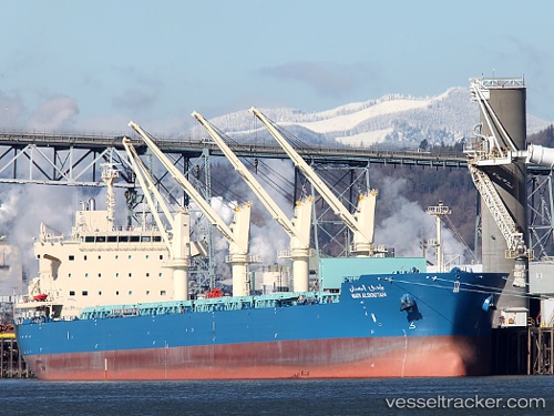
Wadi Albostan
Current StatusWhere is the vessel?
Wadi Albostan is currently in Near Port Said, based on AIS data received less than 1h ago.
Latest AIS update:
Current position: 31.36711° N, 32.31294° E (Near Port Said)
Average speed (last 7 days): Loading…
Average speed (last 30 days): Loading…
Vessel profile: Wadi Albostan is a Bulk Carrier with dimensions 32m x 189m.
This page combines live AIS, route history, probable destination signals, nearby traffic, and port activity for practical vessel monitoring.
The current position of vessel Wadi Albostan is 31.36711 lat / 32.31294 lng. Updated: 2026-04-26 16:11:54 UTCNearest reference points:
- Near Port Said
- 14 nm N of Port Said
- 15 nm N of Port Said
Details:
Live Vessel Wadi Albostan Analytics (details, animations, etc.)
Recent AIS points (UTC):
2026-04-26 13:06:54 UTC · 31.00484, 32.31106 · SOG 11.6 kn · COG 357°2026-04-26 14:14:54 UTC · 31.17060, 32.32862 · SOG 7.2 kn · COG 12°
2026-04-26 16:10:24 UTC · 31.36677, 32.31352 · SOG 1.9 kn · COG 321°
2026-04-26 16:11:54 UTC · 31.36711, 32.31294 · SOG 1.1 kn · COG 336°