 vesseltracker.com
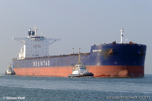
 Sunny Star
Current Status
Where is the vessel?
Sunny Star is currently in 13 nm NE of SURALAYA, based on AIS data received about 3h ago.
Latest AIS update:
Current position: 5.75821° S, 106.23067° E (13 nm NE of SURALAYA)
Average speed (last 7 days): Loading…
Average speed (last 30 days): Loading…
Vessel profile: Sunny Star is a Bulk Carrier with dimensions 292m x 45m.
This page combines live AIS, route history, probable destination signals, nearby traffic, and port activity for practical vessel monitoring.
The current position of vessel Sunny Star is -5.75821 lat / 106.23067 lng. Updated: 2026-05-14 23:44:08 UTCNearest reference points:
- Near SURALAYA
- Near CILEGON
- Near MERAK
Currently sailing under the flag of Panama ![]()
Sunny Star built in 2011 year
Deadweight:
179843 tDetails:
Live Vessel Sunny Star Analytics (details, animations, etc.)
Recent AIS points (UTC):
2026-05-14 20:17:57 UTC · -5.94054, 105.78713 · SOG 7.5 kn · COG 32°2026-05-14 22:13:57 UTC · -5.79945, 105.98856 · SOG 9.4 kn · COG 78°
2026-05-14 22:30:28 UTC · -5.79160, 106.03183 · SOG 9.8 kn · COG 80°
2026-05-14 23:44:08 UTC · -5.75821, 106.23067 · SOG 10 kn · COG 81°