 vesseltracker.com
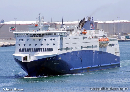
 Nova Star
Current Status
Where is the vessel?
Nova Star is currently in 13 nm NE of Lubiszewo, based on AIS data received less than 1h ago.
Latest AIS update:
Current position: 54.89039° N, 18.86807° E (13 nm NE of Lubiszewo)
Average speed (last 7 days): Loading…
Average speed (last 30 days): Loading…
Vessel profile: Nova Star is a Passenger Ro Ro Cargo Ship with dimensions 161m x 26m.
This page combines live AIS, route history, probable destination signals, nearby traffic, and port activity for practical vessel monitoring.
The current position of vessel Nova Star is 54.89039 lat / 18.86807 lng. Updated: 2026-04-24 18:03:51 UTCNearest reference points:
- Near WLADYSLAWOWO
- Near Sopot
- Near Gdynia
Currently sailing under the flag of Bahamas ![]()
Nova Star built in 2011 year
Deadweight:
4145 tDetails:
Live Vessel Nova Star Analytics (details, animations, etc.)
Recent AIS points (UTC):
2026-04-24 14:02:46 UTC · 54.40405, 18.67811 · SOG 0 kn · COG 288°2026-04-24 16:10:24 UTC · 54.42787, 18.64954 · SOG 10 kn · COG 16°
2026-04-24 16:12:34 UTC · 54.43319, 18.65361 · SOG 11.2 kn · COG 36°
2026-04-24 18:03:51 UTC · 54.89039, 18.86807 · SOG 17.6 kn · COG 350°