 vesseltracker.com
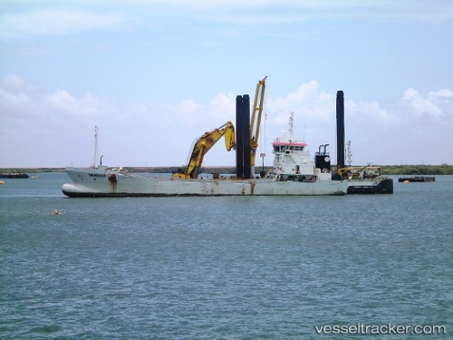
 Trinidad
Current Status
Where is the vessel?
Trinidad is currently in Near Suape, based on AIS data received less than 1h ago.
Latest AIS update:
Current position: 8.38352° S, 34.96851° W (Near Suape)
Average speed (last 7 days): Loading…
Average speed (last 30 days): Loading…
Vessel profile: Trinidad is a Service Ship with dimensions 82m x 17m.
This page combines live AIS, route history, probable destination signals, nearby traffic, and port activity for practical vessel monitoring.
The current position of vessel Trinidad is -8.38352 lat / -34.96851 lng. Updated: 2026-04-30 08:04:56 UTCNearest reference points:
- Near Suape
- Near Boa Viagem
- Near Barra dos Coqueiros
Currently sailing under the flag of Luxembourg ![]()
Trinidad built in 2010 year
Deadweight:
3400 tDetails:
Live Vessel Trinidad Analytics (details, animations, etc.)
Recent AIS points (UTC):
2026-04-30 04:30:15 UTC · -8.38350, -34.96849 · SOG 0 kn · COG 181°2026-04-30 05:29:14 UTC · -8.38354, -34.96851 · SOG 0 kn · COG 181°
2026-04-30 07:40:44 UTC · -8.38354, -34.96848 · SOG 0 kn · COG 181°
2026-04-30 08:04:56 UTC · -8.38352, -34.96851 · SOG 0 kn · COG 181°