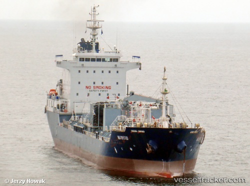
 SARONIC BAY
Current Status
Where is the vessel?
SARONIC BAY is currently in 230 nm E of Puerto Deseado, based on AIS data received about 15h ago.
Latest AIS update:
Current position: 47.03150° S, 60.37015° W (230 nm E of Puerto Deseado)
Average speed (last 7 days): Loading…
Average speed (last 30 days): Loading…
Vessel profile: SARONIC BAY is a Chemical/Oil Products Tanker with dimensions 20m x 128m.
This page combines live AIS, route history, probable destination signals, nearby traffic, and port activity for practical vessel monitoring.
The current position of vessel SARONIC BAY is -47.03150 lat / -60.37015 lng. Updated: 2026-05-24 08:23:21 UTCCurrently sailing under the flag of Liberia ![]()
SARONIC BAY built in 2011 year
Deadweight:
13151 tDetails:
Live Vessel SARONIC BAY Analytics (details, animations, etc.)
Recent AIS points (UTC):
2026-05-24 05:00:50 UTC · -47.33500, -60.40333 · SOG 7 kn · COG -1°2026-05-24 05:28:52 UTC · -47.28311, -60.40948 · SOG 6.5 kn · COG 345°
2026-05-24 07:33:06 UTC · -47.07210, -60.37336 · SOG 3.5 kn · COG 350°
2026-05-24 08:23:21 UTC · -47.03150, -60.37015 · SOG 2.2 kn · COG 347°