 vesseltracker.com
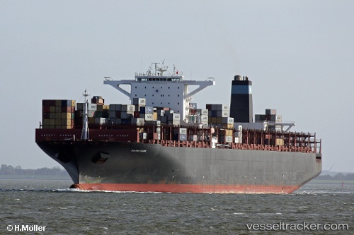
 Msc Natasha
Current Status
Where is the vessel?
Msc Natasha is currently in 316 nm S of Bela Vista, based on AIS data received about 1h ago.
Latest AIS update:
Current position: 27.04554° S, 36.87677° W (316 nm S of Bela Vista)
Average speed (last 7 days): Loading…
Average speed (last 30 days): Loading…
Vessel profile: Msc Natasha is a Container Ship with dimensions 366m x 366m.
This page combines live AIS, route history, probable destination signals, nearby traffic, and port activity for practical vessel monitoring.
The current position of vessel Msc Natasha is -27.04554 lat / -36.87677 lng. Updated: 2026-05-15 07:57:08 UTCCurrently sailing under the flag of Liberia ![]()
Msc Natasha built in 2011 year
Deadweight:
141398 tDetails:
Live Vessel Msc Natasha Analytics (details, animations, etc.)
Recent AIS points (UTC):
2026-05-15 04:53:01 UTC · -26.28861, -37.34267 · SOG 16.5 kn · COG 136°2026-05-15 05:35:01 UTC · -26.45575, -37.23255 · SOG 16.8 kn · COG 153°
2026-05-15 07:39:26 UTC · -26.97221, -36.92376 · SOG 17 kn · COG 152°
2026-05-15 07:57:08 UTC · -27.04554, -36.87677 · SOG 17 kn · COG 152°