 vesseltracker.com
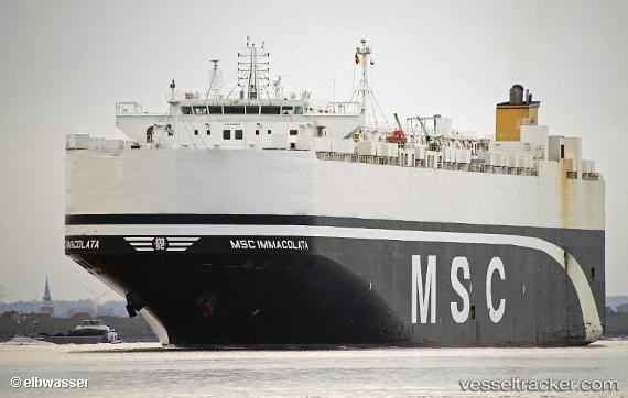
 Msc Immacolata
Current Status
Where is the vessel?
Msc Immacolata is currently in 219 nm SE of Al Azaiba, based on AIS data received less than 1h ago.
Latest AIS update:
Current position: 25.72451° S, 61.79772° E (219 nm SE of Al Azaiba)
Average speed (last 7 days): Loading…
Average speed (last 30 days): Loading…
Vessel profile: Msc Immacolata is a Vehicles Carrier with dimensions 199m x 32m.
This page combines live AIS, route history, probable destination signals, nearby traffic, and port activity for practical vessel monitoring.
The current position of vessel Msc Immacolata is -25.72451 lat / 61.79772 lng. Updated: 2026-04-29 01:44:44 UTCNearest reference points:
- Open sea, approx. 407 nm off the nearest listed port
- Open sea, approx. 409 nm off the nearest listed port
- Open sea, approx. 414 nm off the nearest listed port
Currently sailing under the flag of Panama ![]()
Msc Immacolata built in 2012 year
Deadweight:
22196 tDetails:
Live Vessel Msc Immacolata Analytics (details, animations, etc.)
Recent AIS points (UTC):
2026-04-28 22:52:14 UTC · -25.92737, 61.10256 · SOG 13.7 kn · COG 69°2026-04-29 00:29:44 UTC · -25.81655, 61.49567 · SOG 13.6 kn · COG 67°
2026-04-29 01:38:13 UTC · -25.73228, 61.77128 · SOG 13.7 kn · COG 67°
2026-04-29 01:44:44 UTC · -25.72451, 61.79772 · SOG 13.8 kn · COG 68°