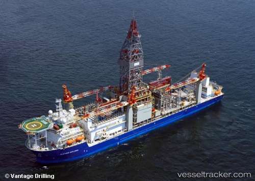
Platinum Explorer
Current StatusWhere is the vessel?
Platinum Explorer is currently in Near LABUAN, based on AIS data received about 15h ago.
Latest AIS update:
Current position: 5.16049° N, 115.18518° E (Near LABUAN)
Average speed (last 7 days): Loading…
Average speed (last 30 days): Loading…
Vessel profile: Platinum Explorer is a Drilling Ship with dimensions 42m x 238m.
This page combines live AIS, route history, probable destination signals, nearby traffic, and port activity for practical vessel monitoring.
The current position of vessel Platinum Explorer is 5.16049 lat / 115.18518 lng. Updated: 2026-05-23 10:22:27 UTCNearest reference points:
- Near Kikeh
- 44 nm SW of Tembungo
- Near Kota Kinabalu
Details:
Live Vessel Platinum Explorer Analytics (details, animations, etc.)
Recent AIS points (UTC):
2026-05-23 07:31:27 UTC · 5.16096, 115.18546 · SOG 0 kn · COG -1°2026-05-23 08:13:27 UTC · 5.16086, 115.18550 · SOG 0 kn · COG 282°
2026-05-23 10:07:28 UTC · 5.16055, 115.18531 · SOG 0 kn · COG 322°
2026-05-23 10:22:27 UTC · 5.16049, 115.18518 · SOG 0 kn · COG 333°