 vesseltracker.com
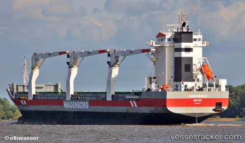
 Andesborg
Current Status
Where is the vessel?
Andesborg is currently in Near Bekkeri, based on AIS data received less than 1h ago.
Latest AIS update:
Current position: 59.46157° N, 24.65282° E (Near Bekkeri)
Average speed (last 7 days): Loading…
Average speed (last 30 days): Loading…
Vessel profile: Andesborg is a General Cargo Ship with dimensions 142m x 142m.
This page combines live AIS, route history, probable destination signals, nearby traffic, and port activity for practical vessel monitoring.
The current position of vessel Andesborg is 59.46157 lat / 24.65282 lng. Updated: 2026-05-14 00:10:51 UTCNearest reference points:
- Near Vanasadam
- Near Aegna
- Near Nurme
Currently sailing under the flag of Netherlands ![]()
Andesborg built in 2011 year
Deadweight:
17294 tDetails:
Live Vessel Andesborg Analytics (details, animations, etc.)
Recent AIS points (UTC):
2026-05-13 20:16:52 UTC · 59.46162, 24.65280 · SOG 0 kn · COG 121°2026-05-13 21:31:51 UTC · 59.46156, 24.65274 · SOG 0 kn · COG 120°
2026-05-13 22:40:51 UTC · 59.46157, 24.65277 · SOG 0 kn · COG 121°
2026-05-14 00:10:51 UTC · 59.46157, 24.65282 · SOG 0 kn · COG 120°