 vesseltracker.com
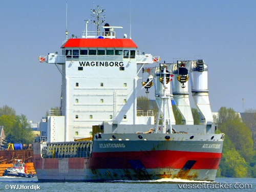
Atlanticborg
Current StatusWhere is the vessel?
Atlanticborg is currently in Near Kirkehamn, based on AIS data received about 1h ago.
Latest AIS update:
Current position: 58.10279° N, 6.46039° E (Near Kirkehamn)
Average speed (last 7 days): Loading…
Average speed (last 30 days): Loading…
Vessel profile: Atlanticborg is a General Cargo Ship with dimensions 22m x 143m.
This page combines live AIS, route history, probable destination signals, nearby traffic, and port activity for practical vessel monitoring.
The current position of vessel Atlanticborg is 58.10279 lat / 6.46039 lng. Updated: 2026-05-15 13:29:45 UTCNearest reference points:
- Near Kirkehamn
- Near Åna-Sira
- Near Egersund
Details:
Live Vessel Atlanticborg Analytics (details, animations, etc.)
Recent AIS points (UTC):
2026-05-15 10:15:29 UTC · 58.27425, 6.88798 · SOG 0 kn · COG 31°2026-05-15 11:42:38 UTC · 58.27231, 6.88006 · SOG 2.2 kn · COG 194°
2026-05-15 13:09:06 UTC · 58.15398, 6.51555 · SOG 11.1 kn · COG 230°
2026-05-15 13:29:45 UTC · 58.10279, 6.46039 · SOG 10.8 kn · COG 152°