 vesseltracker.com
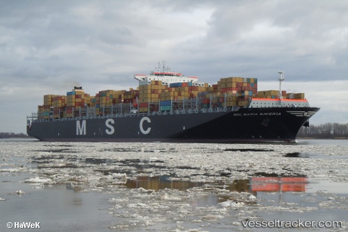
 Msc Maria Saveria
Current Status
Where is the vessel?
Msc Maria Saveria is currently in Near Daxie Pt, based on AIS data received about 1h ago.
Latest AIS update:
Current position: 29.89027° N, 122.04565° E (Near Daxie Pt)
Average speed (last 7 days): Loading…
Average speed (last 30 days): Loading…
Vessel profile: Msc Maria Saveria is a Container Ship with dimensions 366m x 366m.
This page combines live AIS, route history, probable destination signals, nearby traffic, and port activity for practical vessel monitoring.
The current position of vessel Msc Maria Saveria is 29.89027 lat / 122.04565 lng. Updated: 2026-04-28 00:11:37 UTCNearest reference points:
- Near Daxie Pt
- Near Majistan/Zhoushan
- Near ZHOUSHAN
Currently sailing under the flag of Panama ![]()
Msc Maria Saveria built in 2011 year
Deadweight:
139294 tDetails:
Live Vessel Msc Maria Saveria Analytics (details, animations, etc.)
Recent AIS points (UTC):
2026-04-27 19:47:36 UTC · 29.89017, 122.04551 · SOG 0 kn · COG 289°2026-04-27 21:32:34 UTC · 29.89010, 122.04565 · SOG 0 kn · COG 289°
2026-04-27 22:08:35 UTC · 29.89028, 122.04536 · SOG 0 kn · COG 289°
2026-04-28 00:11:37 UTC · 29.89027, 122.04565 · SOG 0 kn · COG 289°