 vesseltracker.com
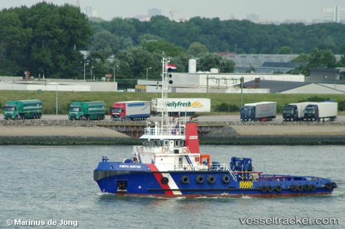
 ALMA KAPPA
Current Status
Where is the vessel?
ALMA KAPPA is currently in Near L'Île-d'Yeu, based on AIS data received less than 1h ago.
Latest AIS update:
Current position: 46.79507° N, 2.45363° W (Near L'Île-d'Yeu)
Average speed (last 7 days): Loading…
Average speed (last 30 days): Loading…
Vessel profile: ALMA KAPPA is a Tug with dimensions 12m x 37m.
This page combines live AIS, route history, probable destination signals, nearby traffic, and port activity for practical vessel monitoring.
The current position of vessel ALMA KAPPA is 46.79507 lat / -2.45363 lng. Updated: 2026-04-29 02:54:00 UTCNearest reference points:
- 13 nm S of Saint-Céols
- 12 nm S of Saint-Céols
- Near LA BARRE DE MONTS
Currently sailing under the flag of France (RIF) ![]()
ALMA KAPPA built in 2008 year
Deadweight:
325 tDetails:
Live Vessel ALMA KAPPA Analytics (details, animations, etc.)
Recent AIS points (UTC):
2026-04-28 22:29:43 UTC · 46.82714, -2.42383 · SOG 3.5 kn · COG 34°2026-04-28 23:58:56 UTC · 46.86362, -2.47365 · SOG 4.6 kn · COG 233°
2026-04-29 01:45:11 UTC · 46.80214, -2.49499 · SOG 3.1 kn · COG 98°
2026-04-29 02:54:00 UTC · 46.79507, -2.45363 · SOG 1.6 kn · COG 144°