 vesseltracker.com
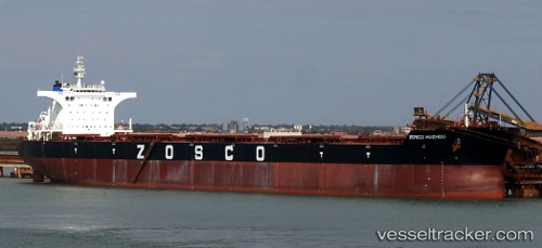
Berge Nimba
Current StatusWhere is the vessel?
Berge Nimba is currently in 85 nm N of TAN TAN, based on AIS data received about 1h ago.
Latest AIS update:
Current position: 29.81500° N, 11.91167° W (85 nm N of TAN TAN)
Average speed (last 7 days): Loading…
Average speed (last 30 days): Loading…
Vessel profile: Berge Nimba is a Bulk Carrier with dimensions 45m x 292m.
This page combines live AIS, route history, probable destination signals, nearby traffic, and port activity for practical vessel monitoring.
The current position of vessel Berge Nimba is 29.81500 lat / -11.91167 lng. Updated: 2026-05-14 11:29:59 UTCNearest reference points:
- 84 nm NE of ORZOLA
- 120 nm W of Anza
- 125 nm W of Essaouira
Details:
Live Vessel Berge Nimba Analytics (details, animations, etc.)
Recent AIS points (UTC):
2026-05-14 07:22:32 UTC · 29.20167, -12.49500 · SOG 11 kn · COG -1°2026-05-14 09:39:27 UTC · 29.54648, -12.18752 · SOG 11.7 kn · COG 42°
2026-05-14 10:35:38 UTC · 29.68167, -12.04667 · SOG 11 kn · COG -1°
2026-05-14 11:29:59 UTC · 29.81500, -11.91167 · SOG 11 kn · COG -1°