 vesseltracker.com
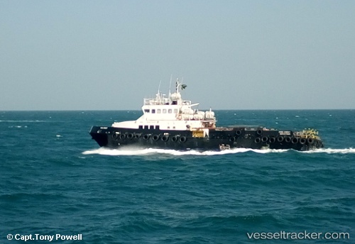
Firecrest
Current StatusWhere is the vessel?
Firecrest is currently in Near Ras Tannurah, based on AIS data received less than 1h ago.
Latest AIS update:
Current position: 26.67429° N, 50.29408° E (Near Ras Tannurah)
Average speed (last 7 days): Loading…
Average speed (last 30 days): Loading…
Vessel profile: Firecrest is a Offshore Tug Supply Ship with dimensions 8m x 36m.
This page combines live AIS, route history, probable destination signals, nearby traffic, and port activity for practical vessel monitoring.
The current position of vessel Firecrest is 26.67429 lat / 50.29408 lng. Updated: 2026-05-01 01:51:02 UTCNearest reference points:
- Near Ad Dammam
- Near DAMMAM
- Near Sayhat
Details:
Live Vessel Firecrest Analytics (details, animations, etc.)
Recent AIS points (UTC):
2026-04-30 22:26:23 UTC · 26.68145, 50.29901 · SOG 0.9 kn · COG 163°2026-04-30 22:55:02 UTC · 26.68125, 50.29684 · SOG 3.2 kn · COG 148°
2026-05-01 00:19:09 UTC · 26.68009, 50.29445 · SOG 3 kn · COG 189°
2026-05-01 01:51:02 UTC · 26.67429, 50.29408 · SOG 0.4 kn · COG 158°