 vesseltracker.com
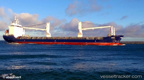
 Rike
Rike
Current Status
Where is the vessel?
Rike is currently in 16 nm SE of Mtwalume, based on AIS data received less than 1h ago.
Latest AIS update:
Current position: 30.60616° S, 30.89829° E (16 nm SE of Mtwalume)
Average speed (last 7 days): Loading…
Average speed (last 30 days): Loading…
Vessel profile: Rike is a Multi Purpose Carrier with dimensions 138m x 21m.
This page combines live AIS, route history, probable destination signals, nearby traffic, and port activity for practical vessel monitoring.
The current position of vessel Rike is -30.60616 lat / 30.89829 lng. Updated: 2026-05-15 04:05:06 UTCNearest reference points:
- Near Island View
- Near Durban
- Near Umhlanga Rocks
Currently sailing under the flag of Antigua Barbuda ![]()
Rike built in 2010 year
Deadweight:
12654 tDetails:
Live Vessel Rike Analytics (details, animations, etc.)
Recent AIS points (UTC):
2026-05-14 22:45:26 UTC · -29.87459, 31.51832 · SOG 10.8 kn · COG 218°2026-05-15 00:01:26 UTC · -30.04937, 31.36127 · SOG 9.8 kn · COG 222°
2026-05-15 01:01:22 UTC · -30.18110, 31.25077 · SOG 9.8 kn · COG 215°
2026-05-15 04:05:06 UTC · -30.60616, 30.89829 · SOG 9.8 kn · COG 217°