 vesseltracker.com
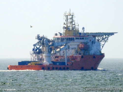
 NORMAND VALIANT
Current Status
Where is the vessel?
NORMAND VALIANT is currently in 18 nm E of Fluminense FPSO, based on AIS data received about 1h ago.
Latest AIS update:
Current position: 22.54218° S, 40.12313° W (18 nm E of Fluminense FPSO)
Average speed (last 7 days): Loading…
Average speed (last 30 days): Loading…
Vessel profile: NORMAND VALIANT is a Offshore Supply Ship with dimensions 20m x 76m.
This page combines live AIS, route history, probable destination signals, nearby traffic, and port activity for practical vessel monitoring.
The current position of vessel NORMAND VALIANT is -22.54218 lat / -40.12313 lng. Updated: 2026-04-28 00:15:54 UTCNearest reference points:
- Near Fluminense FPSO
- Near PORTO DO ACU
- 24 nm SE of Carapebus
Currently sailing under the flag of Brazil ![]()
NORMAND VALIANT built in 2008 year
Deadweight:
3111 tDetails:
Live Vessel NORMAND VALIANT Analytics (details, animations, etc.)
Recent AIS points (UTC):
2026-04-27 20:11:53 UTC · -22.55899, -40.12169 · SOG 0.5 kn · COG 33°2026-04-27 21:41:15 UTC · -22.54667, -40.12167 · SOG 1 kn · COG -1°
2026-04-27 22:59:40 UTC · -22.54258, -40.12237 · SOG 0.2 kn · COG 32°
2026-04-28 00:15:54 UTC · -22.54218, -40.12313 · SOG 0.3 kn · COG 30°