 vesseltracker.com
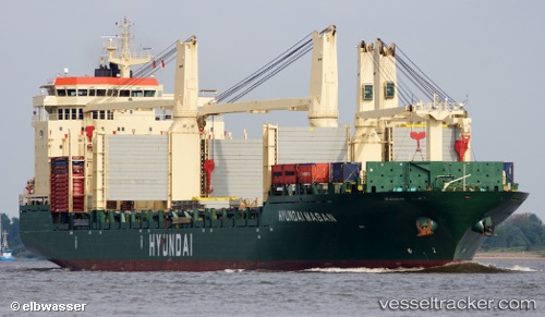
Hyundai Masan
Current StatusWhere is the vessel?
Hyundai Masan is currently in 13 nm SW of Air Parcel Sorting Office/Mumbai, based on AIS data received about 2h ago.
Latest AIS update:
Current position: 18.79728° N, 72.59904° E (13 nm SW of Air Parcel Sorting Office/Mumbai)
Average speed (last 7 days): Loading…
Average speed (last 30 days): Loading…
Vessel profile: Hyundai Masan is a Multi Purpose Carrier with dimensions 28m x 192m.
This page combines live AIS, route history, probable destination signals, nearby traffic, and port activity for practical vessel monitoring.
The current position of vessel Hyundai Masan is 18.79728 lat / 72.59904 lng. Updated: 2026-05-15 00:59:08 UTCNearest reference points:
- Near Mumbai
- Near HNB SEZ/Mumbai
- Near NHAVA SHEVA
Details:
Live Vessel Hyundai Masan Analytics (details, animations, etc.)
Recent AIS points (UTC):
2026-05-14 21:32:01 UTC · 18.82466, 72.54284 · SOG 9.1 kn · COG 148°2026-05-14 22:56:08 UTC · 18.79662, 72.59855 · SOG 0.7 kn · COG 317°
2026-05-14 23:48:30 UTC · 18.79667, 72.59833 · SOG 0 kn · COG -1°
2026-05-15 00:59:08 UTC · 18.79728, 72.59904 · SOG 0.6 kn · COG 293°