 vesseltracker.com
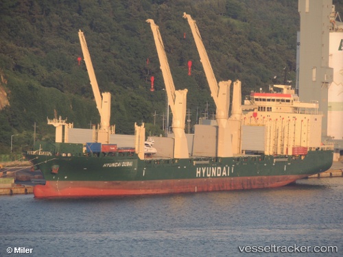
 Hyundai Dubai
Current Status
Where is the vessel?
Hyundai Dubai is currently in 68 nm SE of Quintana, based on AIS data received about 1h ago.
Latest AIS update:
Current position: 28.08833° N, 94.40833° W (68 nm SE of Quintana)
Average speed (last 7 days): Loading…
Average speed (last 30 days): Loading…
Vessel profile: Hyundai Dubai is a Multi Purpose Carrier with dimensions 193m x 28m.
This page combines live AIS, route history, probable destination signals, nearby traffic, and port activity for practical vessel monitoring.
The current position of vessel Hyundai Dubai is 28.08833 lat / -94.40833 lng. Updated: 2026-05-02 17:41:17 UTCNearest reference points:
- 63 nm SE of Quintana
- 56 nm SE of Quintana
- 49 nm SE of Sheppard
Currently sailing under the flag of Marshall Is ![]()
Hyundai Dubai built in 2011 year
Deadweight:
30104 tDetails:
Live Vessel Hyundai Dubai Analytics (details, animations, etc.)
Recent AIS points (UTC):
2026-05-02 13:44:18 UTC · 27.23500, -94.41167 · SOG 13 kn · COG -1°2026-05-02 15:50:20 UTC · 27.69500, -94.42167 · SOG 12 kn · COG -1°
2026-05-02 16:32:17 UTC · 27.84500, -94.42333 · SOG 12 kn · COG -1°
2026-05-02 17:41:17 UTC · 28.08833, -94.40833 · SOG 12 kn · COG -1°