 vesseltracker.com
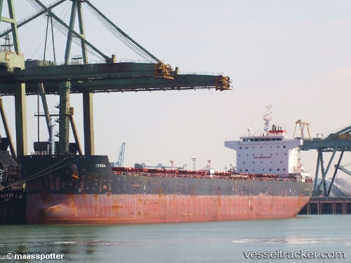
 SUNRISE I
Current Status
Where is the vessel?
SUNRISE I is currently in 79 nm E of Hrubcice, based on AIS data received less than 1h ago.
Latest AIS update:
Current position: 50.05615° N, 174.54289° E (79 nm E of Hrubcice)
Average speed (last 7 days): Loading…
Average speed (last 30 days): Loading…
Vessel profile: SUNRISE I is a Bulk Carrier with dimensions 32m x 229m.
This page combines live AIS, route history, probable destination signals, nearby traffic, and port activity for practical vessel monitoring.
The current position of vessel SUNRISE I is 50.05615 lat / 174.54289 lng. Updated: 2026-04-23 19:45:57 UTCNearest reference points:
- 57 nm SW of Zagorow
Currently sailing under the flag of Marshall Islands ![]()
SUNRISE I built in 2010 year
Deadweight:
80370 tDetails:
Live Vessel SUNRISE I Analytics (details, animations, etc.)
Recent AIS points (UTC):
2026-04-23 16:06:27 UTC · 50.17913, 175.54349 · SOG 10.3 kn · COG 259°2026-04-23 18:05:57 UTC · 50.10946, 175.01450 · SOG 11 kn · COG 259°
2026-04-23 19:11:18 UTC · 50.07272, 174.70779 · SOG 11.2 kn · COG 259°
2026-04-23 19:45:57 UTC · 50.05615, 174.54289 · SOG 11.2 kn · COG 260°