 vesseltracker.com
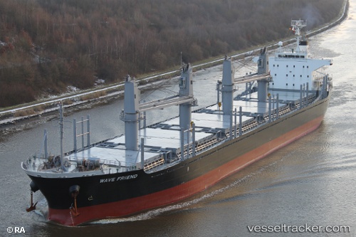
 KHARIS TRINITY
Current Status
Where is the vessel?
KHARIS TRINITY is currently in Near Shimonoseki, based on AIS data received less than 1h ago.
Latest AIS update:
Current position: 33.93609° N, 130.94467° E (Near Shimonoseki)
Average speed (last 7 days): Loading…
Average speed (last 30 days): Loading…
Vessel profile: KHARIS TRINITY is a Bulk Carrier with dimensions 170m x 27m.
This page combines live AIS, route history, probable destination signals, nearby traffic, and port activity for practical vessel monitoring.
The current position of vessel KHARIS TRINITY is 33.93609 lat / 130.94467 lng. Updated: 2026-05-17 07:29:35 UTCNearest reference points:
- Near Shimonoseki
- Near Kokura
- Near Kanmon
Currently sailing under the flag of Korea (Republic of) ![]()
KHARIS TRINITY built in 2010 year
Deadweight:
28368 tDetails:
Live Vessel KHARIS TRINITY Analytics (details, animations, etc.)
Recent AIS points (UTC):
2026-05-17 04:14:35 UTC · 33.93608, 130.94464 · SOG 0 kn · COG 206°2026-05-17 05:35:35 UTC · 33.93605, 130.94466 · SOG 0 kn · COG 206°
2026-05-17 07:23:34 UTC · 33.93611, 130.94470 · SOG 0 kn · COG 206°
2026-05-17 07:29:35 UTC · 33.93609, 130.94467 · SOG 0 kn · COG 206°