 vesseltracker.com
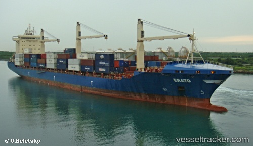
 Erato
Erato
Current Status
Where is the vessel?
Erato is currently in 21 nm N of Progreso, based on AIS data received about 1h ago.
Latest AIS update:
Current position: 21.69833° N, 89.67833° W (21 nm N of Progreso)
Average speed (last 7 days): Loading…
Average speed (last 30 days): Loading…
Vessel profile: Erato is a Container Ship with dimensions 209m x 209m.
This page combines live AIS, route history, probable destination signals, nearby traffic, and port activity for practical vessel monitoring.
The current position of vessel Erato is 21.69833 lat / -89.67833 lng. Updated: 2026-04-30 04:10:34 UTCNearest reference points:
- 19 nm N of Progreso
Currently sailing under the flag of Liberia ![]()
Erato built in 2011 year
Deadweight:
34162 tDetails:
Live Vessel Erato Analytics (details, animations, etc.)
Recent AIS points (UTC):
2026-04-30 01:46:34 UTC · 21.65500, -89.77667 · SOG 4 kn · COG -1°2026-04-30 01:52:34 UTC · 21.64833, -89.77500 · SOG 4 kn · COG -1°
2026-04-30 03:25:37 UTC · 21.70050, -89.66567 · SOG 0.7 kn · COG 107°
2026-04-30 04:10:34 UTC · 21.69833, -89.67833 · SOG 1 kn · COG -1°