 vesseltracker.com
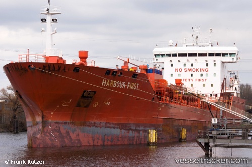
 Harbour First
Current Status
Where is the vessel?
Harbour First is currently in 13 nm E of NESSEBAR, based on AIS data received about 1h ago.
Latest AIS update:
Current position: 42.60956° N, 28.01132° E (13 nm E of NESSEBAR)
Average speed (last 7 days): Loading…
Average speed (last 30 days): Loading…
Vessel profile: Harbour First is a Chemical Oil Products Tanker with dimensions 144m x 23m.
This page combines live AIS, route history, probable destination signals, nearby traffic, and port activity for practical vessel monitoring.
The current position of vessel Harbour First is 42.60956 lat / 28.01132 lng. Updated: 2026-05-16 17:30:16 UTCNearest reference points:
- Near Varna
- 20 nm SE of Varna
- Near Beloslav
Currently sailing under the flag of Portugal ![]()
Harbour First built in 2011 year
Deadweight:
16894 tDetails:
Live Vessel Harbour First Analytics (details, animations, etc.)
Recent AIS points (UTC):
2026-05-16 14:03:18 UTC · 41.88540, 28.65437 · SOG 14.8 kn · COG 325°2026-05-16 16:09:26 UTC · 42.32138, 28.25554 · SOG 14.7 kn · COG 330°
2026-05-16 16:24:23 UTC · 42.37416, 28.21019 · SOG 15 kn · COG 325°
2026-05-16 17:30:16 UTC · 42.60956, 28.01132 · SOG 14.9 kn · COG 329°