 vesseltracker.com
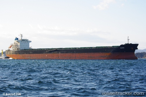
 Samoa
Samoa
Current Status
Where is the vessel?
Samoa is currently in 204 nm E of Ramalde, based on AIS data received about 1h ago.
Latest AIS update:
Current position: 40.44667° S, 4.25833° W (204 nm E of Ramalde)
Average speed (last 7 days): Loading…
Average speed (last 30 days): Loading…
Vessel profile: Samoa is a Bulk Carrier with dimensions 225m x 225m.
This page combines live AIS, route history, probable destination signals, nearby traffic, and port activity for practical vessel monitoring.
The current position of vessel Samoa is -40.44667 lat / -4.25833 lng. Updated: 2026-05-17 06:18:48 UTCCurrently sailing under the flag of Malta ![]()
Samoa built in 2010 year
Deadweight:
75506 tDetails:
Live Vessel Samoa Analytics (details, animations, etc.)
Recent AIS points (UTC):
2026-05-17 02:12:40 UTC · -40.29903, -5.19075 · SOG 10.7 kn · COG 103°2026-05-17 03:39:35 UTC · -40.35074, -4.86585 · SOG 10.5 kn · COG 101°
2026-05-17 04:10:04 UTC · -40.36822, -4.75201 · SOG 10.6 kn · COG 102°
2026-05-17 06:18:48 UTC · -40.44667, -4.25833 · SOG 11 kn · COG -1°