 vesseltracker.com
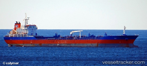
Kei
Current StatusWhere is the vessel?
Kei is currently in 112 nm SW of Panakukang, based on AIS data received less than 1h ago.
Latest AIS update:
Current position: 5.94833° S, 117.67667° E (112 nm SW of Panakukang)
Average speed (last 7 days): Loading…
Average speed (last 30 days): Loading…
Vessel profile: Kei is a Oil Products Tanker with dimensions 24m x 144m.
This page combines live AIS, route history, probable destination signals, nearby traffic, and port activity for practical vessel monitoring.
The current position of vessel Kei is -5.94833 lat / 117.67667 lng. Updated: 2026-05-13 19:17:29 UTCNearest reference points:
- 117 nm W of Panakukang
- 74 nm NE of Pagerungan
- 37 nm E of Pagerungan
Details:
Live Vessel Kei Analytics (details, animations, etc.)
Recent AIS points (UTC):
2026-05-13 15:56:28 UTC · -6.05500, 117.26333 · SOG 7 kn · COG -1°2026-05-13 15:56:28 UTC · -6.05500, 117.26333 · SOG 7 kn · COG -1°
2026-05-13 17:32:27 UTC · -6.03833, 117.47833 · SOG 8 kn · COG -1°
2026-05-13 19:17:29 UTC · -5.94833, 117.67667 · SOG 8 kn · COG -1°