 vesseltracker.com
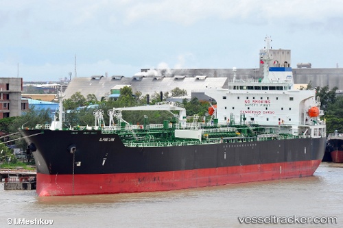
 Alpine Link
Current Status
Where is the vessel?
Alpine Link is currently in 29 nm S of Port Edward, based on AIS data received about 1h ago.
Latest AIS update:
Current position: 31.52912° S, 30.33823° E (29 nm S of Port Edward)
Average speed (last 7 days): Loading…
Average speed (last 30 days): Loading…
Vessel profile: Alpine Link is a Chemical Oil Products Tanker with dimensions 183m x 33m.
This page combines live AIS, route history, probable destination signals, nearby traffic, and port activity for practical vessel monitoring.
The current position of vessel Alpine Link is -31.52912 lat / 30.33823 lng. Updated: 2026-04-28 18:02:52 UTCNearest reference points:
- 23 nm E of Port Saint John's
- Near Island View
- Near Durban
Currently sailing under the flag of Marshall Is ![]()
Alpine Link built in 2010 year
Deadweight:
50209 tDetails:
Live Vessel Alpine Link Analytics (details, animations, etc.)
Recent AIS points (UTC):
2026-04-28 14:17:22 UTC · -31.28833, 30.54833 · SOG 6 kn · COG -1°2026-04-28 16:02:20 UTC · -31.40500, 30.44667 · SOG 4 kn · COG -1°
2026-04-28 16:15:40 UTC · -31.41937, 30.43836 · SOG 4.5 kn · COG 206°
2026-04-28 18:02:52 UTC · -31.52912, 30.33823 · SOG 4.8 kn · COG 211°