 vesseltracker.com
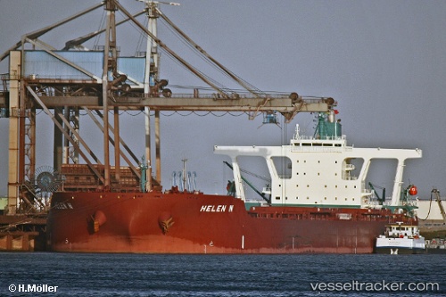
Helen N
Current StatusWhere is the vessel?
Helen N is currently in 269 nm S of Antofagasta, based on AIS data received less than 1h ago.
Latest AIS update:
Current position: 28.11833° S, 70.12833° E (269 nm S of Antofagasta)
Average speed (last 7 days): Loading…
Average speed (last 30 days): Loading…
Vessel profile: Helen N is a Ore Carrier with dimensions 55m x 327m.
This page combines live AIS, route history, probable destination signals, nearby traffic, and port activity for practical vessel monitoring.
The current position of vessel Helen N is -28.11833 lat / 70.12833 lng. Updated: 2026-05-17 10:26:04 UTCNearest reference points:
- Open sea (no nearby ports in database)
- Open sea, approx. 402 nm off the nearest listed port
- Open sea, approx. 406 nm off the nearest listed port
Details:
Live Vessel Helen N Analytics (details, animations, etc.)
Recent AIS points (UTC):
2026-05-17 06:07:57 UTC · -28.44333, 69.35667 · SOG 10 kn · COG -1°2026-05-17 07:02:30 UTC · -28.38008, 69.52760 · SOG 10.7 kn · COG 69°
2026-05-17 08:11:13 UTC · -28.29992, 69.73855 · SOG 10.2 kn · COG 63°
2026-05-17 10:26:04 UTC · -28.11833, 70.12833 · SOG 10 kn · COG -1°