 vesseltracker.com
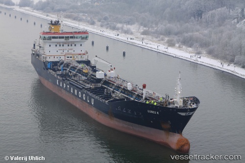
 GUNES K
Current Status
Where is the vessel?
GUNES K is currently in 17 nm SE of Shinas, based on AIS data received less than 1h ago.
Latest AIS update:
Current position: 24.53595° N, 56.69505° E (17 nm SE of Shinas)
Average speed (last 7 days): Loading…
Average speed (last 30 days): Loading…
Vessel profile: GUNES K is a Oil/Chemical Tanker with dimensions m x m.
This page combines live AIS, route history, probable destination signals, nearby traffic, and port activity for practical vessel monitoring.
The current position of vessel GUNES K is 24.53595 lat / 56.69505 lng. Updated: 2026-04-30 19:46:59 UTCNearest reference points:
- 17 nm SE of Shinas
- 18 nm SE of SHINAS
- 42 nm SE of Offshore Fujairah
Currently sailing under the flag of Malta ![]()
Details:
Live Vessel GUNES K Analytics (details, animations, etc.)
Recent AIS points (UTC):
2026-04-30 16:56:01 UTC · 24.53618, 56.69318 · SOG 0 kn · COG 151°2026-04-30 17:50:01 UTC · 24.53644, 56.69357 · SOG 0 kn · COG 170°
2026-04-30 19:23:00 UTC · 24.53633, 56.69465 · SOG 0 kn · COG 224°
2026-04-30 19:46:59 UTC · 24.53595, 56.69505 · SOG 0 kn · COG 251°