 vesseltracker.com
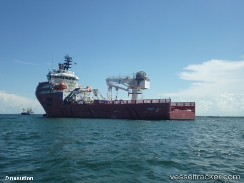
Skandi Hawk
Current StatusWhere is the vessel?
Skandi Hawk is currently in Near Malampaya, based on AIS data received about 2h ago.
Latest AIS update:
Current position: 11.51333° N, 119.12167° E (Near Malampaya)
Average speed (last 7 days): Loading…
Average speed (last 30 days): Loading…
Vessel profile: Skandi Hawk is a Offshore Tug Supply Ship with dimensions 19m x 88m.
This page combines live AIS, route history, probable destination signals, nearby traffic, and port activity for practical vessel monitoring.
The current position of vessel Skandi Hawk is 11.51333 lat / 119.12167 lng. Updated: 2026-05-14 09:41:26 UTCNearest reference points:
- 43 nm W of Malampaya
- 65 nm NW of Malampaya
- 19 nm NE of CORON
Details:
Live Vessel Skandi Hawk Analytics (details, animations, etc.)
Recent AIS points (UTC):
2026-05-14 05:53:24 UTC · 11.51333, 119.12167 · SOG 0 kn · COG -1°2026-05-14 05:53:24 UTC · 11.51333, 119.12167 · SOG 0 kn · COG -1°
2026-05-14 05:53:24 UTC · 11.51333, 119.12167 · SOG 0 kn · COG -1°
2026-05-14 09:41:26 UTC · 11.51333, 119.12167 · SOG 0 kn · COG -1°