 vesseltracker.com
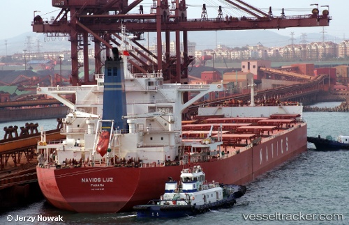
Navios Luz
Current StatusWhere is the vessel?
Navios Luz is currently in Near Luoyuanwan, based on AIS data received about 23d ago.
Latest AIS update:
Current position: 26.45187° N, 119.70867° E (Near Luoyuanwan)
Average speed (last 7 days): Loading…
Average speed (last 30 days): Loading…
Vessel profile: Navios Luz is a Bulk Carrier with dimensions 45m x 292m.
This page combines live AIS, route history, probable destination signals, nearby traffic, and port activity for practical vessel monitoring.
The current position of vessel Navios Luz is 26.45187 lat / 119.70867 lng. Updated: 2026-04-22 04:34:00 UTCNearest reference points:
- Near LUOYUAN
- Near Dongdaiwan
- Near Beijiao
Details:
Live Vessel Navios Luz Analytics (details, animations, etc.)
Recent AIS points (UTC):
2026-04-22 04:34:00 UTC · 26.45187, 119.70867 · SOG 0 kn · COG -1°