 vesseltracker.com
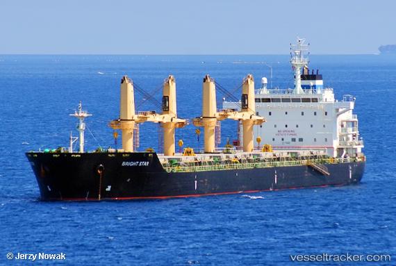
 Bright Star
Current Status
Where is the vessel?
Bright Star is currently in 53 nm N of Atauro, based on AIS data received about 1h ago.
Latest AIS update:
Current position: 7.41392° S, 125.34592° E (53 nm N of Atauro)
Average speed (last 7 days): Loading…
Average speed (last 30 days): Loading…
Vessel profile: Bright Star is a Bulk Carrier with dimensions 180m x 180m.
This page combines live AIS, route history, probable destination signals, nearby traffic, and port activity for practical vessel monitoring.
The current position of vessel Bright Star is -7.41392 lat / 125.34592 lng. Updated: 2026-05-16 11:53:48 UTCNearest reference points:
- 15 nm NE of Atauro
- 101 nm N of Atauro
Currently sailing under the flag of Liberia ![]()
Bright Star built in 2011 year
Deadweight:
35000 tDetails:
Live Vessel Bright Star Analytics (details, animations, etc.)
Recent AIS points (UTC):
2026-05-16 07:34:22 UTC · -6.49228, 125.37913 · SOG 11.9 kn · COG 176°2026-05-16 09:06:10 UTC · -6.81027, 125.37302 · SOG 12.7 kn · COG 177°
2026-05-16 10:36:33 UTC · -7.14088, 125.35175 · SOG 13.5 kn · COG 180°
2026-05-16 11:53:48 UTC · -7.41392, 125.34592 · SOG 12.4 kn · COG 184°