 vesseltracker.com
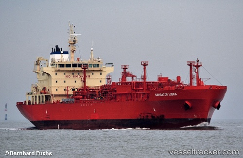
 Navigator Libra
Current Status
Where is the vessel?
Navigator Libra is currently in 29 nm N of Moa, based on AIS data received about 2h ago.
Latest AIS update:
Current position: 21.13833° N, 75.01500° W (29 nm N of Moa)
Average speed (last 7 days): Loading…
Average speed (last 30 days): Loading…
Vessel profile: Navigator Libra is a Lpg Tanker with dimensions 160m x 160m.
This page combines live AIS, route history, probable destination signals, nearby traffic, and port activity for practical vessel monitoring.
The current position of vessel Navigator Libra is 21.13833 lat / -75.01500 lng. Updated: 2026-04-18 03:52:31 UTCNearest reference points:
- 16 nm SE of Ceiba Hueca
- Near Great Exuma Island
Currently sailing under the flag of Liberia ![]()
Navigator Libra built in 2012 year
Deadweight:
22911 tDetails:
Live Vessel Navigator Libra Analytics (details, animations, etc.)
Recent AIS points (UTC):
2026-04-17 21:55:32 UTC · 21.47167, -76.12167 · SOG 10 kn · COG -1°2026-04-18 00:04:31 UTC · 21.35333, -75.72333 · SOG 10 kn · COG -1°
2026-04-18 02:25:33 UTC · 21.22167, -75.28500 · SOG 11 kn · COG -1°
2026-04-18 03:52:31 UTC · 21.13833, -75.01500 · SOG 10 kn · COG -1°