 vesseltracker.com
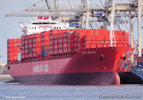
 Cap Jervis
Current Status
Where is the vessel?
Cap Jervis is currently in 133 nm SE of Xijiang, based on AIS data received less than 1h ago.
Latest AIS update:
Current position: 19.67833° N, 116.49500° E (133 nm SE of Xijiang)
Average speed (last 7 days): Loading…
Average speed (last 30 days): Loading…
Vessel profile: Cap Jervis is a Container Ship with dimensions 264m x 32m.
This page combines live AIS, route history, probable destination signals, nearby traffic, and port activity for practical vessel monitoring.
The current position of vessel Cap Jervis is 19.67833 lat / 116.49500 lng. Updated: 2026-05-14 11:52:43 UTCNearest reference points:
- 148 nm SE of Xijiang
- 64 nm SE of Jiazi
- 53 nm S of Jiazi
Currently sailing under the flag of Singapore ![]()
Cap Jervis built in 2010 year
Deadweight:
59266 tDetails:
Live Vessel Cap Jervis Analytics (details, animations, etc.)
Recent AIS points (UTC):
2026-05-14 07:40:41 UTC · 20.29333, 117.02167 · SOG 11 kn · COG -1°2026-05-14 09:16:47 UTC · 20.06333, 116.82167 · SOG 11 kn · COG -1°
2026-05-14 10:43:43 UTC · 19.84833, 116.63833 · SOG 11 kn · COG -1°
2026-05-14 11:52:43 UTC · 19.67833, 116.49500 · SOG 11 kn · COG -1°