 vesseltracker.com
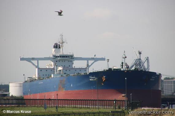
 Nisalah
Current Status
Where is the vessel?
Nisalah is currently in 45 nm NW of Tusdeer Free Zone, based on AIS data received about 2h ago.
Latest AIS update:
Current position: 21.79093° N, 38.40685° E (45 nm NW of Tusdeer Free Zone)
Average speed (last 7 days): Loading…
Average speed (last 30 days): Loading…
Vessel profile: Nisalah is a Crude Oil Tanker with dimensions 333m x 60m.
This page combines live AIS, route history, probable destination signals, nearby traffic, and port activity for practical vessel monitoring.
The current position of vessel Nisalah is 21.79093 lat / 38.40685 lng. Updated: 2026-05-13 22:55:24 UTCNearest reference points:
- 67 nm W of Tusdeer Free Zone
- 64 nm W of Tusdeer Free Zone
- 65 nm SW of King Abdullah City
Currently sailing under the flag of Saudi Arabia ![]()
Nisalah built in 2010 year
Deadweight:
319287 tDetails:
Live Vessel Nisalah Analytics (details, animations, etc.)
Recent AIS points (UTC):
2026-05-13 19:52:51 UTC · 21.24299, 39.27158 · SOG 27.4 kn · COG 170°2026-05-13 22:45:34 UTC · 21.79171, 38.40752 · SOG 0.3 kn · COG 0°
2026-05-13 22:55:24 UTC · 21.79093, 38.40685 · SOG 0.4 kn · COG 350°
2026-05-13 22:55:24 UTC · 21.79093, 38.40685 · SOG 0.4 kn · COG 350°