 vesseltracker.com
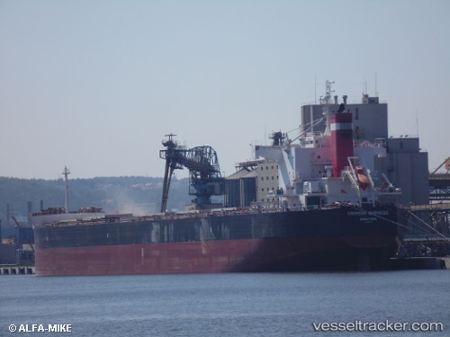
Crimson Empress
Current StatusWhere is the vessel?
Crimson Empress is currently in Near MAASVLAKTE - ROTTERDAM, based on AIS data received about 1h ago.
Latest AIS update:
Current position: 51.93635° N, 4.04834° E (Near MAASVLAKTE - ROTTERDAM)
Average speed (last 7 days): Loading…
Average speed (last 30 days): Loading…
Vessel profile: Crimson Empress is a Bulk Carrier with dimensions 32m x 229m.
This page combines live AIS, route history, probable destination signals, nearby traffic, and port activity for practical vessel monitoring.
The current position of vessel Crimson Empress is 51.93635 lat / 4.04834 lng. Updated: 2026-04-25 12:08:54 UTCNearest reference points:
- Near MAASVLAKTE - ROTTERDAM
- Near HOEK VAN HOLLAND
- Near Rockanje
Details:
Live Vessel Crimson Empress Analytics (details, animations, etc.)
Recent AIS points (UTC):
2026-04-25 08:00:16 UTC · 51.93635, 4.04830 · SOG 0 kn · COG 247°2026-04-25 10:21:03 UTC · 51.93637, 4.04829 · SOG 0 kn · COG 248°
2026-04-25 10:47:57 UTC · 51.93635, 4.04831 · SOG 0 kn · COG 248°
2026-04-25 12:08:54 UTC · 51.93635, 4.04834 · SOG 0 kn · COG 248°