 vesseltracker.com
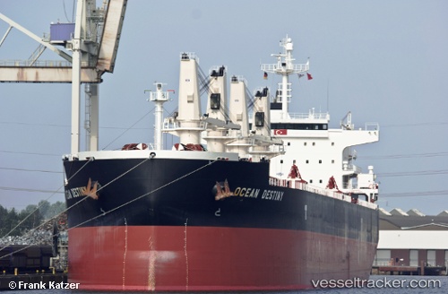
 OCEAN DESTINY
Current Status
Where is the vessel?
OCEAN DESTINY is currently in 92 nm NE of Lü-hua Shan, based on AIS data received about 1h ago.
Latest AIS update:
Current position: 31.66300° N, 124.12233° E (92 nm NE of Lü-hua Shan)
Average speed (last 7 days): Loading…
Average speed (last 30 days): Loading…
Vessel profile: OCEAN DESTINY is a Bulk Carrier with dimensions 33m x 190m.
This page combines live AIS, route history, probable destination signals, nearby traffic, and port activity for practical vessel monitoring.
The current position of vessel OCEAN DESTINY is 31.66300 lat / 124.12233 lng. Updated: 2026-05-14 00:03:41 UTCNearest reference points:
- 117 nm NE of Jingjiang
- 97 nm E of Lü-hua Shan
- 70 nm NE of Jingjiang
Currently sailing under the flag of Liberia ![]()
OCEAN DESTINY built in 2011 year
Deadweight:
55848 tDetails:
Live Vessel OCEAN DESTINY Analytics (details, animations, etc.)
Recent AIS points (UTC):
2026-05-13 19:53:31 UTC · 31.20273, 123.27963 · SOG 13.2 kn · COG 56°2026-05-13 21:18:11 UTC · 31.36502, 123.57652 · SOG 12.6 kn · COG 61°
2026-05-13 22:00:22 UTC · 31.44852, 123.72175 · SOG 12.5 kn · COG 61°
2026-05-14 00:03:41 UTC · 31.66300, 124.12233 · SOG 8.4 kn · COG 75°