 vesseltracker.com
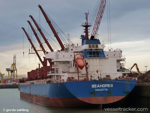
 Seahope Ii
Current Status
Where is the vessel?
Seahope Ii is currently in 124 nm W of Dighi (Pune), based on AIS data received about 1h ago.
Latest AIS update:
Current position: 17.96333° N, 70.81167° E (124 nm W of Dighi (Pune))
Average speed (last 7 days): Loading…
Average speed (last 30 days): Loading…
Vessel profile: Seahope Ii is a Bulk Carrier with dimensions 190m x 32m.
This page combines live AIS, route history, probable destination signals, nearby traffic, and port activity for practical vessel monitoring.
The current position of vessel Seahope Ii is 17.96333 lat / 70.81167 lng. Updated: 2026-05-16 06:35:53 UTCNearest reference points:
- Near Mumbai
- 236 nm SW of Veraval
- 33 nm S of Mul Dwårka
Currently sailing under the flag of Malta ![]()
Seahope Ii built in 2010 year
Deadweight:
56894 tDetails:
Live Vessel Seahope Ii Analytics (details, animations, etc.)
Recent AIS points (UTC):
2026-05-16 02:47:51 UTC · 17.39667, 71.15667 · SOG 10 kn · COG -1°2026-05-16 02:47:51 UTC · 17.39667, 71.15667 · SOG 10 kn · COG -1°
2026-05-16 06:25:05 UTC · 17.94684, 70.82375 · SOG 10.2 kn · COG 327°
2026-05-16 06:35:53 UTC · 17.96333, 70.81167 · SOG 10 kn · COG -1°